
Weather Update: Significant Temperature Drop Expected in the Canary Islands
Impending Weather Change
Starting from Sunday or Monday, a trough will descend over the Peninsula, resulting in atmospheric instability and a significant drop in temperatures.
In the Canary Islands, the heat that has settled in, with temperatures exceeding 34 degrees Celsius and abundant dust, is reluctant to leave and is expected to remain until this weekend. According to forecasts from the European Centre for Medium-Range Weather Forecasts (ECMWF), a much-anticipated change in the weather will occur, bringing cooler temperatures and even rain to several islands.
Forecaster Insights
As explained by José Miguel Viñas, a meteorology expert at Meteored, the trough will create instability in the atmosphere, leading to a sharp decline in temperatures, also affecting the Canary Islands, along with potential thunderstorms that could be severe in parts of the Peninsula.
Forecast by AEMET
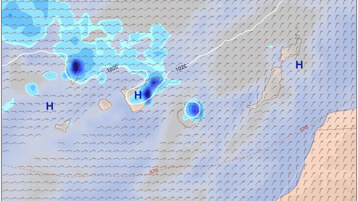
The State Meteorological Agency (Aemet) indicates in its forecast maps that La Palma and, particularly, Tenerife will experience precipitation starting Sunday. Additionally, light rain may occur in the northern part of Gran Canaria by Monday.
Temperature Forecast for the Coming Days
Regarding temperatures, Aemet states that on Saturday, the maximum in Santa Cruz de Tenerife will reach 34 degrees Celsius, dropping to 30 on Sunday, 27 on Monday, and 26 on Tuesday, marking a decrease of eight degrees within three days.
In Las Palmas de Gran Canaria, the temperature will decline from a maximum of 30 degrees on Saturday to 24 degrees on Monday and Tuesday. This indicates that the current heatwave, which has triggered yellow weather warnings across the archipelago, may be coming to an end.


