
On Sunday, warnings will be issued across all the islands, except Fuerteventura and Lanzarote. For this Friday and Saturday, Gran Canaria is currently the only island affected by maximum temperatures of up to 35ºC.
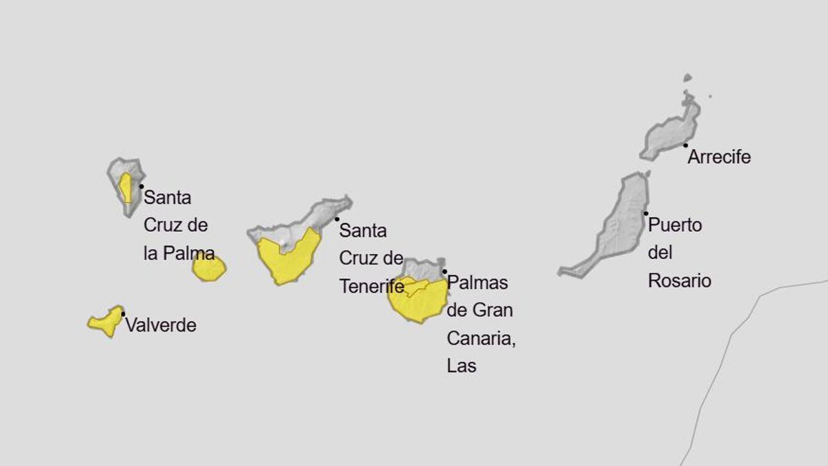
The State Meteorological Agency (Aemet) has updated its warnings for high temperatures in the Canary Islands for these days. Most of the islands, except Lanzarote and Fuerteventura, are under a yellow warning this Sunday.
Gran Canaria is the only island currently under a yellow heat warning this Friday and Saturday.
These are the yellow warnings and the weather forecast according to Aemet for the coming days in the islands:
Friday
Gran Canaria is the only island currently with a yellow warning active for maximum temperatures from 11:00 to 20:00, with a probability of over 70% that maximum temperatures will reach 35ºC in areas facing south and west of Gran Canaria.
In general, light haze is expected at high levels, with mostly clear skies and intervals of medium clouds in the eastern province, and low clouds in the northern mountainous areas, as well as the northern and western coasts of Lanzarote and Fuerteventura.
Temperatures will remain stable or slightly decrease overall, with a more pronounced drop in minimum values on the southern and eastern slopes.
A moderate easterly wind will have strong intervals on the southeast and northwest coasts, with breezes predominating on the southwestern coasts of the mountainous islands. In the highest peaks of the western islands, the wind will be light to moderate from the west.
Saturday
Gran Canaria is currently the only island under a yellow warning for maximum temperatures from 11:00 to 20:00, with a 40%-70% probability that temperatures may reach up to 34ºC, affecting the east, south, west, and peaks of the island, particularly around median and Tejeda Basin.
In general, the skies will be mostly clear with some medium clouds during the first half of the day and intervals of clouds in low northern areas. Light haze at high levels is expected.
Temperatures will show little change or slight increases, particularly significant in inland areas. Temperatures will exceed 30-32ºC in the western islands.
A moderate easterly wind will have strong intervals on the southeast and northwest coasts, with breezes predominating on the southwestern coasts of the mountainous islands.
Sunday
Yellow warnings are activated for maximum temperatures on the islands of Gran Canaria, Tenerife, La Palma, La Gomera, and El Hierro, from 11:00 to 20:00.
In Gran Canaria, with a 40%-70% probability, temperatures may reach 36ºC, affecting Tejeda Basin and the southeast, south, and west.
The other affected islands will experience maximums of 34ºC, with a 10%-40% probability, particularly affecting areas facing south and west.
In general, skies will be mostly clear or sunny. Cloud intervals are expected in low northern areas, with developing clouds over Las Cañadas in Tenerife.
Light haze will affect median and high levels.
Temperatures will rise slightly, with localised moderate increases in inland areas.
Temperatures will exceed 34-36ºC in Tejeda Basin and areas facing south and west of Gran Canaria. This threshold may also be locally reached in the southern and western areas of the western islands.
A moderate easterly wind will blow strongly on the southeast and northwest slopes with locally very strong gusts. Breezes will prevail on the southwestern coasts of the mountainous islands.


