
Weather Forecast for Sunday in the Canary Islands and Rest of Spain
MADRID/SANTA CRUZ DE TENERIFE, 20 Sep. (EUROPA PRESS) –
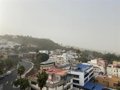
This Sunday, the Canary Islands will experience mostly clear skies, although the larger islands will see increasing cloud cover in the afternoon. Dust levels will begin to decrease throughout the day, with more significant reductions expected in the western province, according to the State Meteorological Agency (Aemet).
Additionally, temperatures will generally decrease, with a notable drop in the central and eastern islands. Maximum temperatures will range from 29 degrees Celsius on Gran Canaria to a minimum of 21 degrees Celsius on El Hierro.
Regarding the wind, it will blow lightly to moderately from the north, shifting to a moderate north-east breeze in the afternoon, with strong gusts in the north-west and south-east by the day’s end. In the mountains, winds will be moderate from the north-west, easing to light in the late hours.
Weather Across the Rest of the Country
The arrival of an Atlantic front from the north-west will cause a significant drop in temperatures across nearly all of the Peninsula, along with rainfall in the north-west third that could be locally heavy in the Pyrenees and Upper Ebro region.
Temperatures will decrease significantly in the north-west and interior of the Peninsula, with maximums dropping between five and eight degrees, except in Levante and the Balearic Islands. However, only five provincial capitals—Seville, Valencia, Murcia, Córdoba, and Granada—are expected to exceed 32°C during the peak sunshine hours. The rest will see temperatures ranging between 25 and 30 degrees.
Likewise, minimum temperatures will also drop by around three to five degrees throughout Spain on Sunday. Few regions will exceed 20°C, with places such as Ávila (7°C), Burgos (4°C), Palencia (6°C), and Lugo (8°C) experiencing more autumn-like temperatures.
Nonetheless, minimums in the Mediterranean, Canary Islands, and Guadalquivir regions will remain between 17-22°C on average.
On a different note, as the front moves through, skies will progressively darken from west to east, particularly over the Cantabrian and western Pyrenees, where rainfall may be heavy and persistent as the day progresses.
In certain areas of the northern third and in eastern mountains, showers may be accompanied by storms, most intense in the Upper Ebro, western Pyrenees, and Iberian region. In the Canary Islands, only occasional showers are expected in the mountains.
Regarding the wind, a westward direction will dominate on the Atlantic and Cantabrian slopes, shifting to north-west by the end of the day, with strong gusts likely in exposed areas, particularly along the coasts. In the Canary Islands, a moderate trade wind is forecasted.


